Video News
User login
Who's online
There are currently 0 users online.
Sponsored by

![]()
Associated with

Maps
|
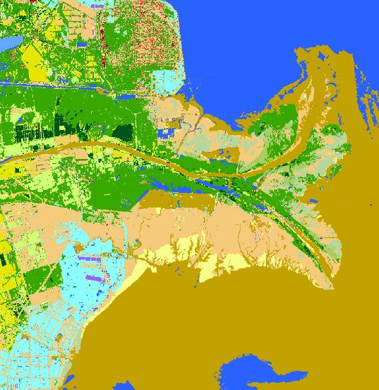
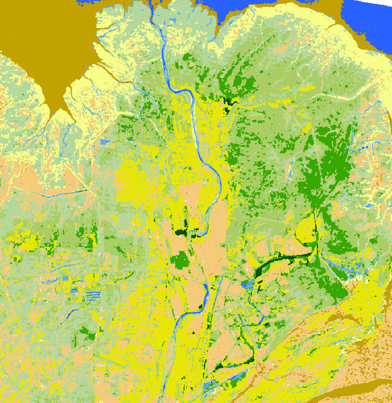
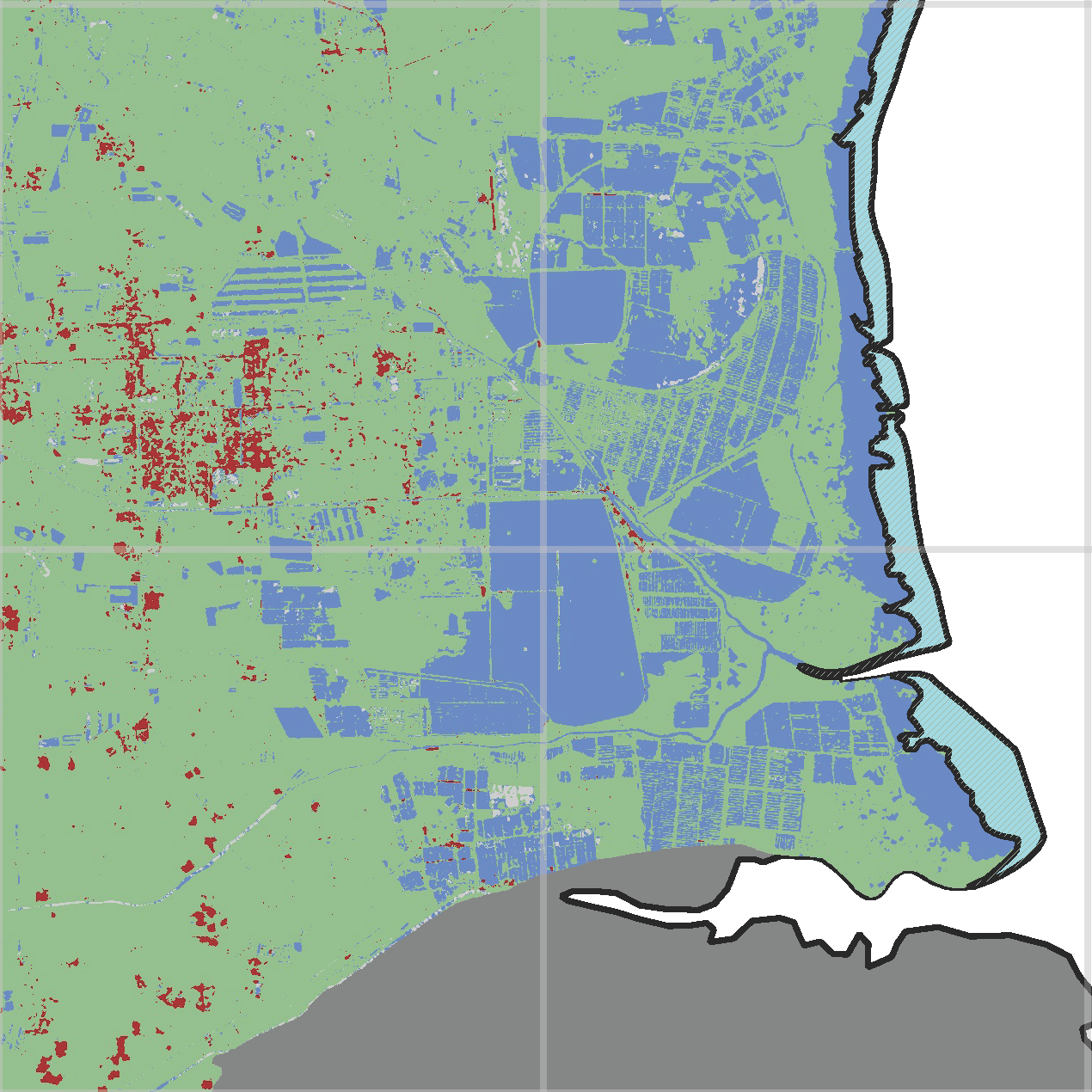
Land Cover Classification
The map shows a land cover classification based on Landsat data from October 2013. DOWNLOAD |
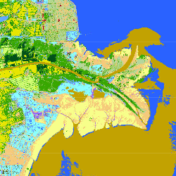
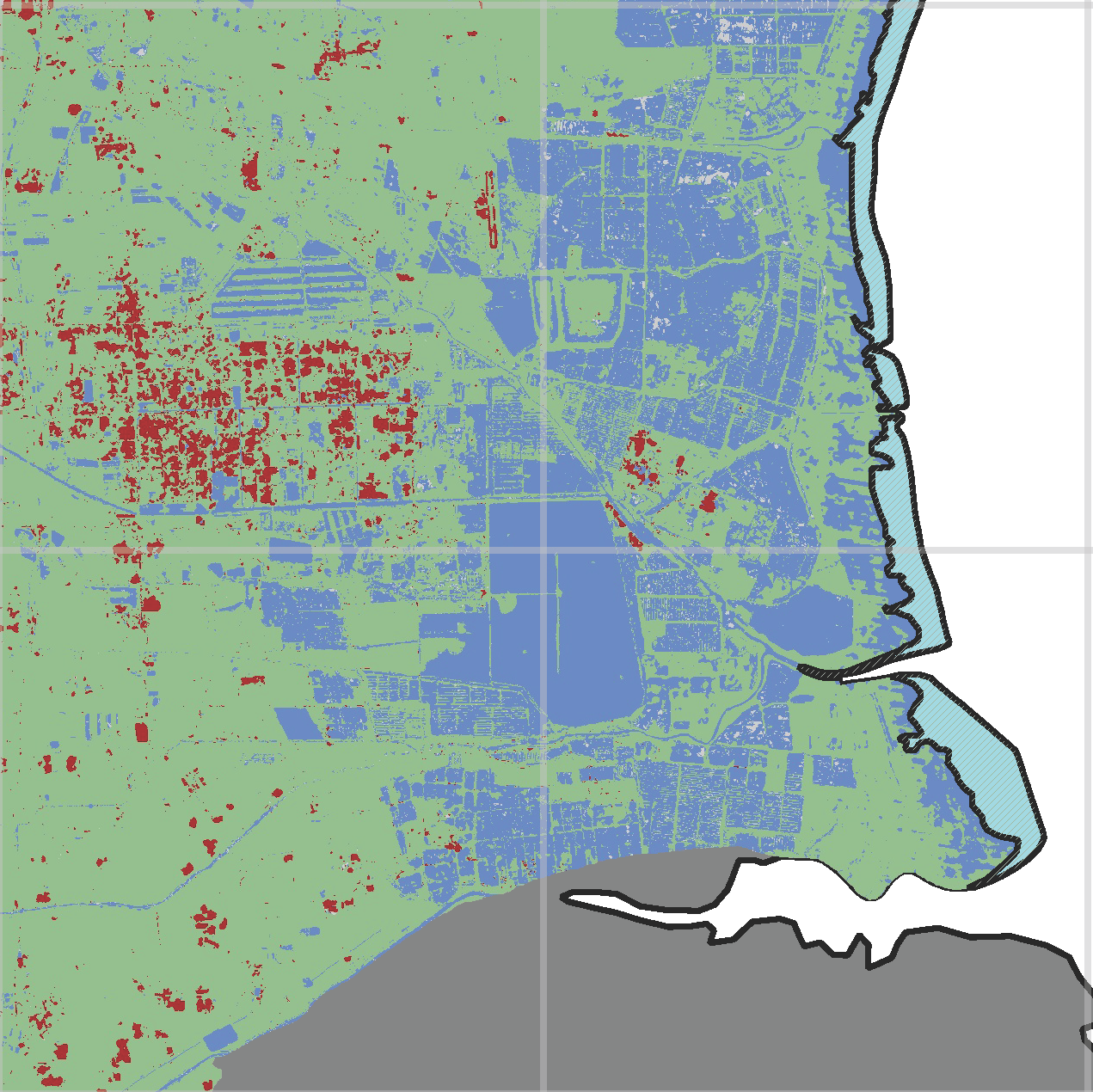
Land Cover Classification
The map shows a land cover classification based on Landsat data from September 2010. DOWNLOAD |
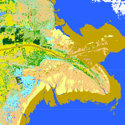
Land Cover Classification
The map shows a land cover classification based on Landsat data from September 2004. DOWNLOAD |
||
|
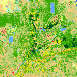
Land Cover Classification
The map shows a land cover classification based on Landsat data from September 1995. DOWNLOAD
|
Land Cover Classification
The map shows a land cover classification based on Landsat data from September 1979. DOWNLOAD
|
|||
|
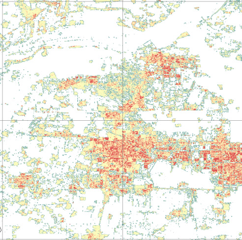
Estimated building height
The map shows the estimated building height derived from the TanDEM-X IDEM. DOWNLOAD
|
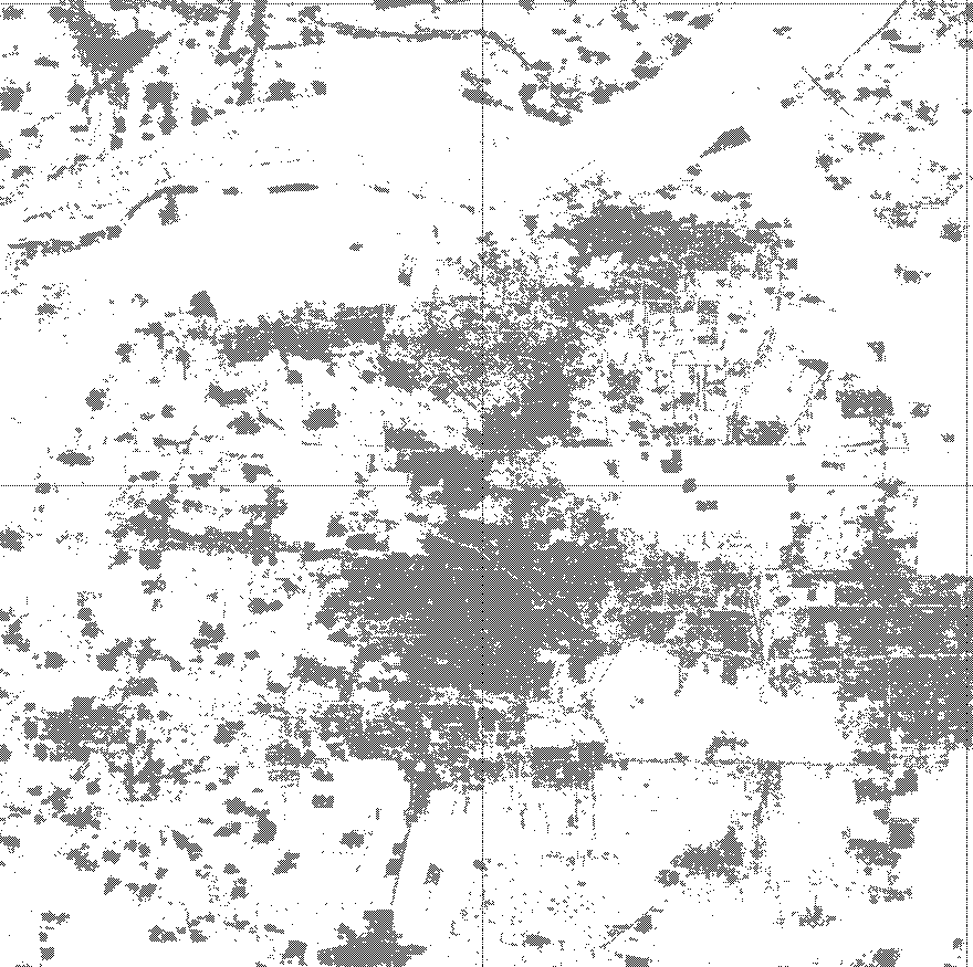
Estimated extent of built-up structure
The map shows the estimated built-up structures derived from TDX/TSX data acquired between 2011 and 2012. DOWNLOAD
|
|||
|
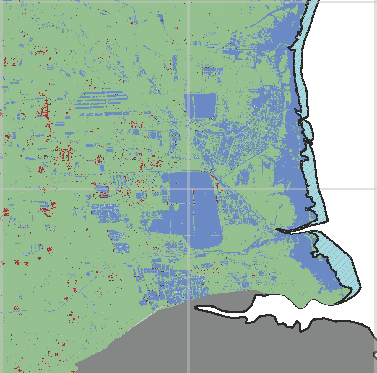
Areas with development potential
The map shows built-up areas and areas potentially suitable for future built-up in 1995. This map was derived using the Land Cover Map 1995 generated from Landsat data.DOWNLOAD
|
Areas with development potential
The map shows built-up areas and areas potentially suitable for future built-up in 2004. This map was derived using the Land Cover Map 2004 generated from Landsat data. DOWNLOAD
|
Areas with development potential
The map shows built-up areas and areas potentially suitable for future built-up in 2010. This map was derived using the Land Cover Map 2010 generated from Landsat data.DOWNLOAD
|
||
|
Map of Urban Sprawl
The map shows the development of built-up areas of Dongying West. DOWNLOAD |
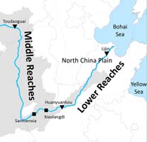
Yellow River Basin -
Overview Map of the Yellow River Basin. DOWNLOAD |