Video News
User login
Who's online
There are currently 0 users online.
Sponsored by

![]()
Associated with

Distribution of agricultural areas in 2010
Agriculture plays an important role for the economy of Dongying district. The following figure illustrates the distribution of irrigated crops (red areas) and dry crops (orange areas) in the year 2010 within Dongying district. As can be seen from the figure, large parts of the Yellow River Delta were used for agriculture.
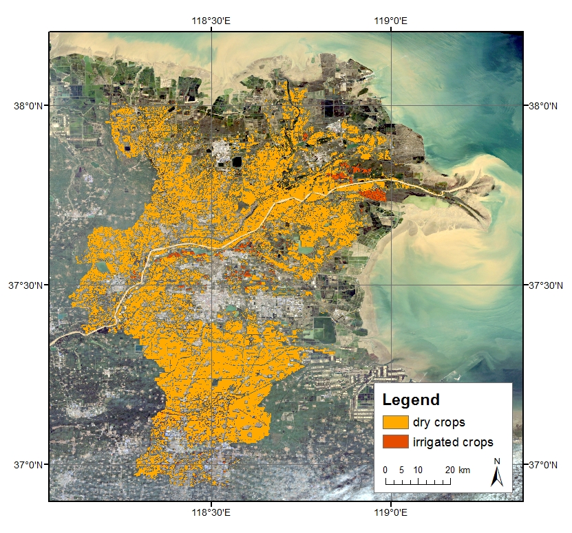
The agricultural areas shown in this map have been extracted from the results by Ottinger et al. (2013).
Source: Ottinger et al. (2013): Monitoring land cover dynamics in the Yellow River Delta from 1995 to 2010 based on Landsat 5 TM. Applied Geography, 53-68. DOI: 10.1016/j.apgeog.2013.07.003.