Video News
User login
Who's online
There are currently 0 users online.
Sponsored by

![]()
Associated with

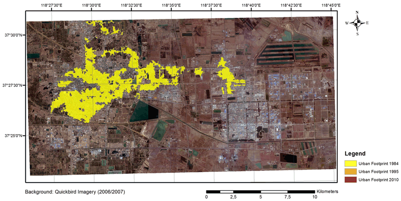
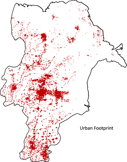
Automatic Spatio-Temporal Mapping of Urban Areas in Dongying City - Preliminary Results
The entire Dongying City area, and particularly Dongying , are experiencing an intense urban development in the last decades. To properly monitor and analyse this key process, in the DELIGHT project we are developing advanced techniques based on satellite Earth Observation data.
In particular, on the one hand, we employ images from the TanDEM-X mission to retrieve the current extent of human settlements (the so-called "Urban Footprint") in the investigated region at very high spatial resolution (VHR) (this also allows to reliably estimate the percentage urban density for each of the 5 districts of Dongying City).
On the other hand, we also account for Landsat imagery to properly characterize the rapid and dynamic urban sprawl occurred from the '80, as it is clearly visible below for the city of Dongying.