Video News
User login
Who's online
There are currently 0 users online.
Sponsored by

![]()
Associated with

Building height estimation – intermediate results
Besides a proper delineation of the extent of built-up areas in the YRD, also a precise estimation of their height is of great importance for reliably characterizing the building volume and, hence, the distribution of the population in the region. In such framework, we implemented a novel unsupervised method developed for automatically deriving the height of built-up areas at the global scale based on the TanDEM-X Digital Elevation Model (DEM) and the Global Urban Footprint (GUF) layer produced at DLR-DFD.
In the first step, we delineate points lying on the ground surface by means of a dedicated algorithm. In particular, the basic idea is that pixels associated with potential infrastructural elements can be identified and then excluded by analyzing the relative change in elevation with respect to their neighbors (indeed they locally exhibit greater height values with respect to ground pixels). Next, the remaining samples are used to generate a digital terrain model (DTM) of the investigated region by employing the Natural Neighbors (NN) interpolation algorithm. The local building height is finally estimated by subtracting the DTM from the original DEM for those pixels marked as urban areas in the GUF. Since the final TanDEM-X DEM is not yet available for the YRD region, in our analysis we considered the Intermediate DEM (IDEM), which has been exclusively derived from data acquired during the first of the two TanDEM-X global coverages (i.e., between 2011 and 2012).
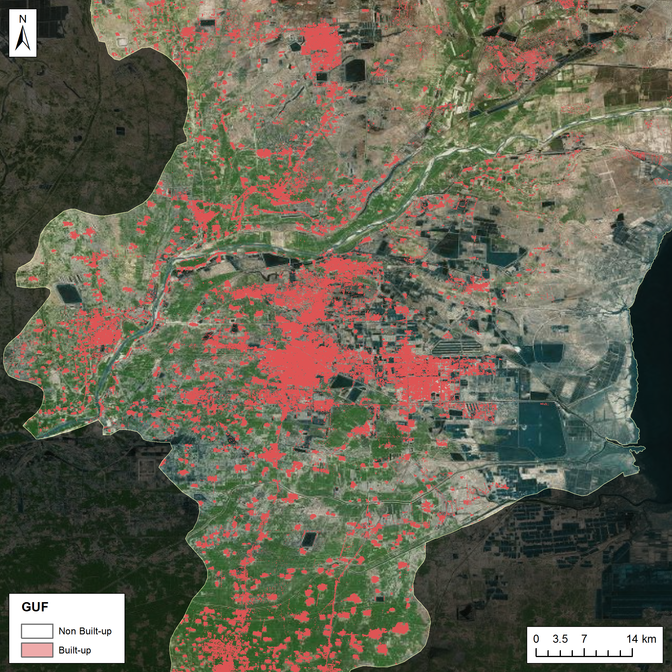
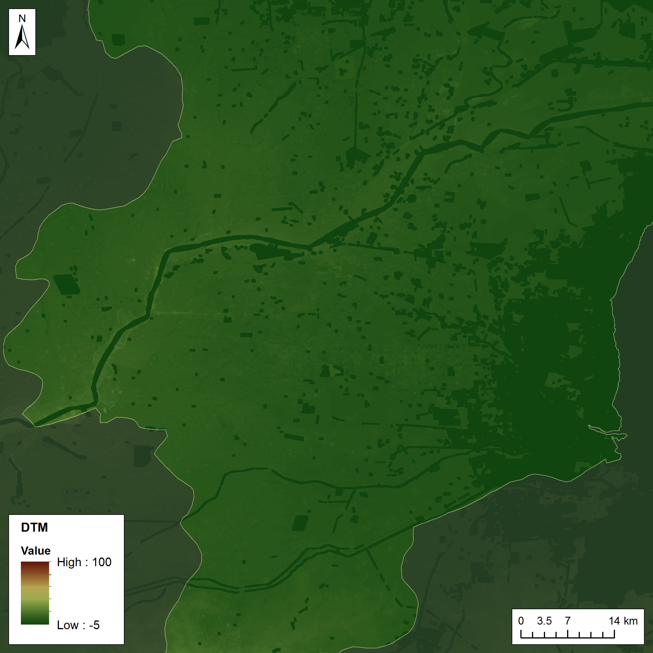
Fig. 1 (left) depicts in red the areas marked as urban in the GUF overlaid to a Landsat RGB true color composition including most of the YRD area.
Fig. 2 (right) shows the corresponding DTM derived with the aforementioned methodology by means of the IDEM data (areas for which a water mask was available appear in dark green).
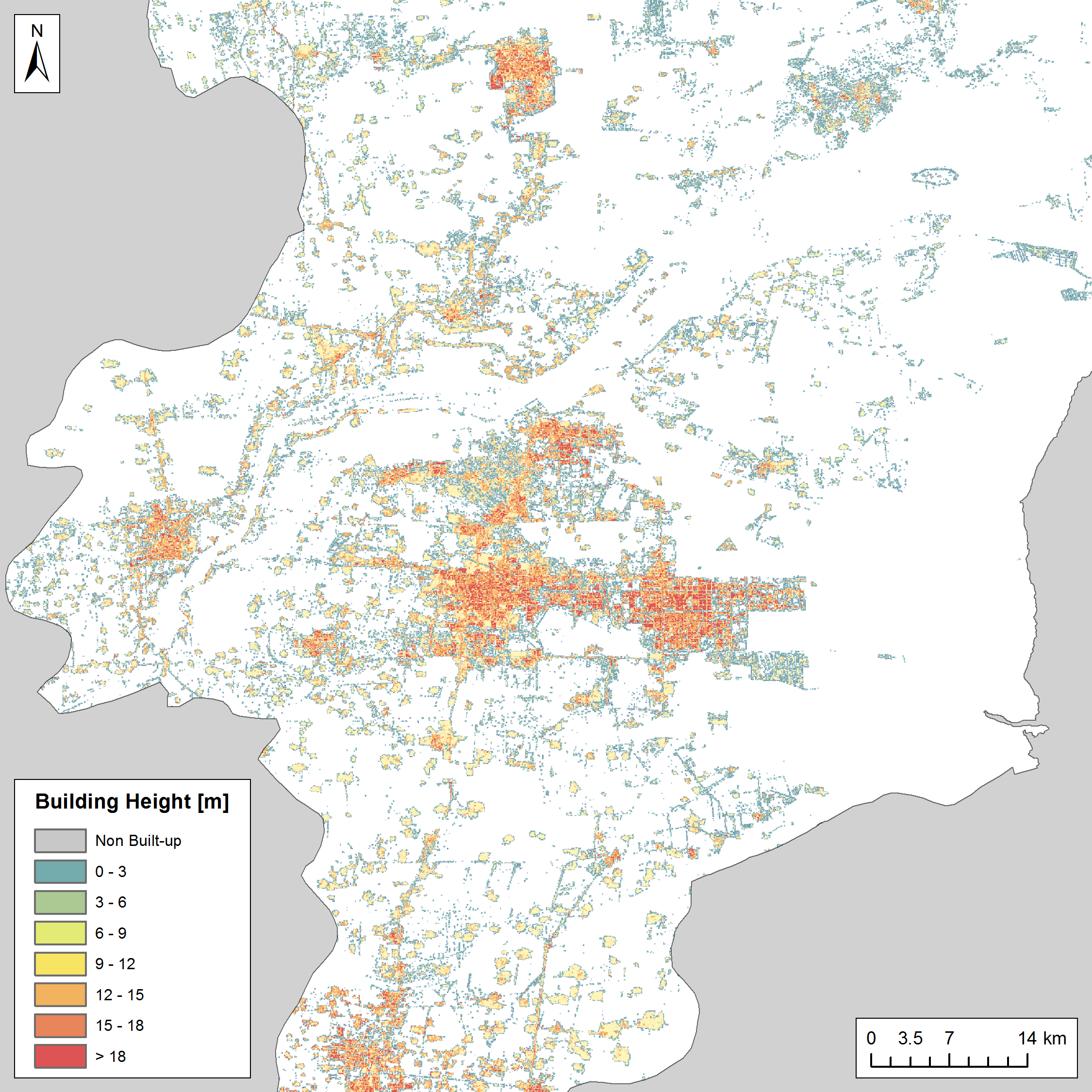
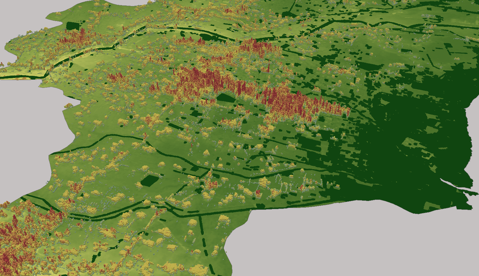
Fig. 3 reports the estimated building height averaged over a 25 by 25 pixel grid (corresponding to an area of ~300x300 m²), along with two perspective views in Fig. 4.