Video News
User login
Who's online
There are currently 0 users online.
Sponsored by

![]()
Associated with

CoastColour processing of MERIS data: changes and improvements on the processing chain
A new reprocessing of the water quality MERIS data from 2005-2012 has been put in place, with improved Water Quality algorithms provided by the CoastColour project and further adjustments for Delight. The processing contains several steps which are depicted in Figure 1. The first steps are a spatial and temporal subsetting from the MERIS FRS archive available at BC. The standard geolocation has been improved using the AMORGOS (Accurate MERIS Ortho-Rectified Geo-location Operational Software) tool, available from ESA and developed by ACRI-ST. Furthermore, the pre-processing includes a radiometric enhancement and an improved pixel classification.
This leads to enhanced L1 products (L1P) which are further processed to water leaving reflectances by applying an atmospheric correction based on neural network. The output is the L2R product. The next step is the water retrieval, which derives the water constituents products which are stored in so called L2W products. Besides chl-a and suspended matter information this includes also Secchi Disk depth and absorption caused by humic substances. The neural net that is applied here is designed for extreme high concentrations of suspended matter, as it occurs in the Bohai Sea. Different algorithms are applied and merged to a set of water quality parameters. Finally, L3 products are generated by temporal aggregation. L3 binning will be performed with the BEAM L3 binning tool, which provides several statistic parameters for each grid cell, among others the average, standard deviation and Percentiles.
All processing steps add metadata to the products which need to be compiled in a Delight specific metadata template.
The applications of the algorithms, the monthly binning and metadata extraction by parameter is done via Calvalus, and has been adapted to the requirements for the Delight products. In Figure 2 there is a screen shot of the L3 processing Calvalus system, with focus on the Bohai Sea area.
The output image and metadata format is selected as in Figure 3: specifying a product file format and selecting the parameter of interest (CHL, CDM, TSM, KDS, etc.).
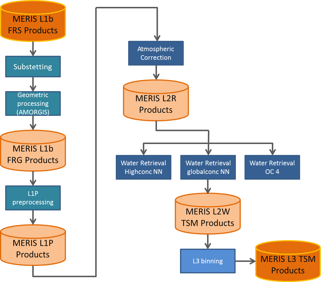
Fig.1: Possible branches of the water pixel processing.
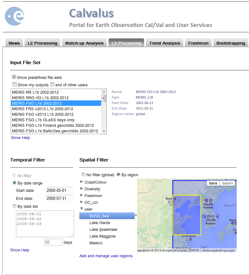
Fig.2: Screenshot of L3 binning processing for the Boha Sea MERIS FSG products).

Fig.3: Screenshot of the output images and metadata formats in Calvalus.