Video News
User login
Who's online
There are currently 0 users online.
Sponsored by

![]()
Associated with

Updated Land Cover Classification for the Yellow River Basin, 2003-2013
Based on time series of MODIS satellite imagery a land cover classification for the whole Yellow River Basin was generated for the years 2003 and 2013. MODIS NDVI time series were analyzed and several phenologic and seasonal parameters, such as start and end of vegetation period, were derived for further processing of the data under the utilization of well-known classification approaches. The result is a regionally adapted land cover map with a spatial resolution of 250m. Agricultural encroachment, urban expansion, and large scale vegetation restoration programs have been the most prominent influencing factors during the last decade.
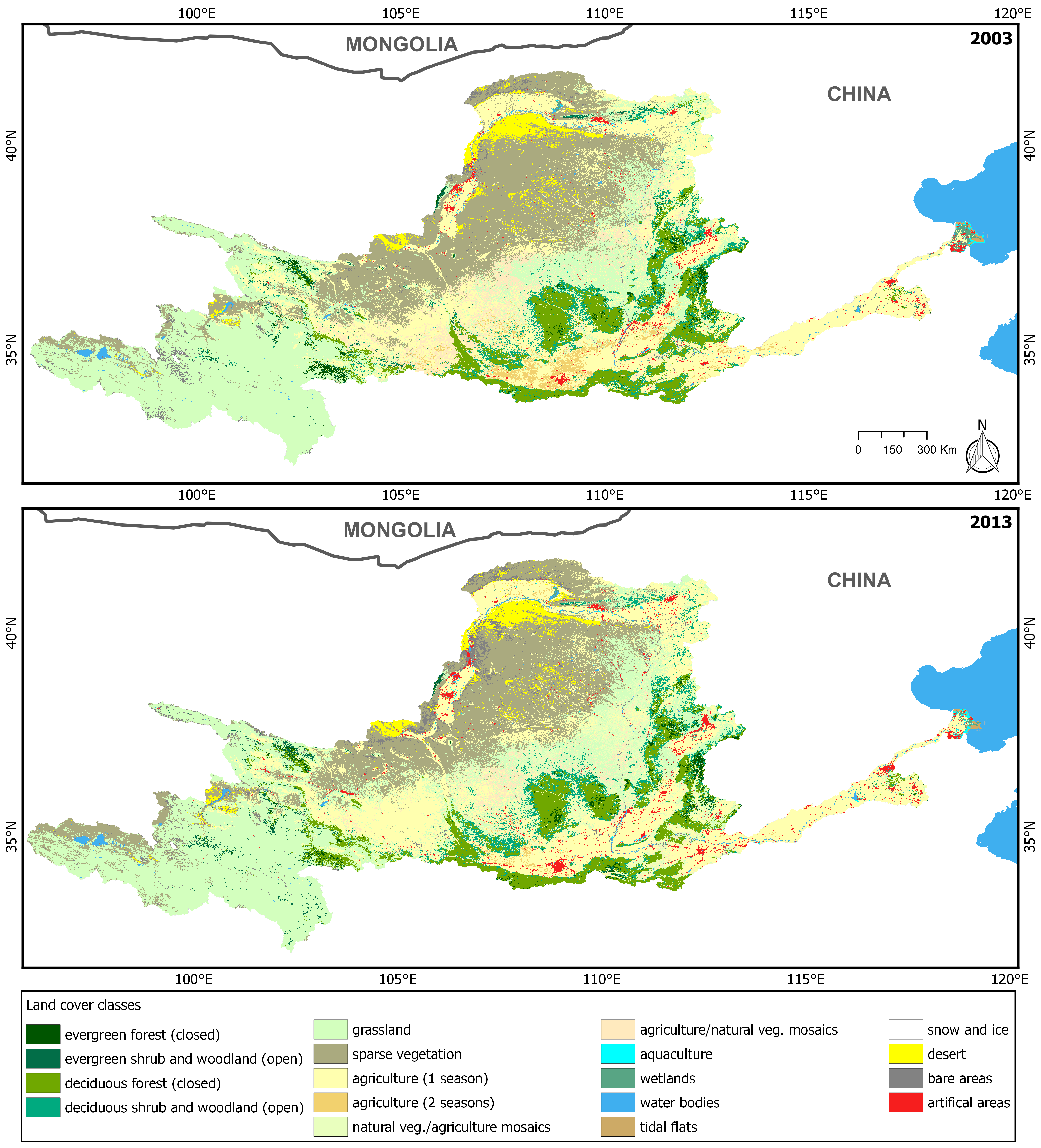
Fig.1: Land Cover Classification Results for the Yellow River Basin for 2003 (top) and 2013 (bottom) (Source: Wohlfart et al. 2016).