Video News
User login
Who's online
There are currently 0 users online.
Sponsored by

![]()
Associated with

Spatial urbanization 1992-2012 derived from multi-source EO data
In order to delineate the past urban extent occurred in the Yellow River Delta (YRD) region, an approach which jointly exploits temporal statistics extracted from multi-temporal ERS-1/2 PRI and ASAR IMP data and from multi-temporal Landsat-5/7 optical data was adopted. Specifically, it was taken into considerations to acquire imagery in 4 different periods of interests, namely 1992-1993, 1997-1998, 2002-2003, 2007-2008. The combination of the final maps reported the Figure below allows to characterize the extensive urbanization experienced by the YRD over 20 years from 1992 to 2012, with a greater increase starting from 2002-2003.
This is evident not only for Dongying at the bottom of the image, but also for Lijin at the left, Hekou at the top left, as well as Gudaozhen and Xianhezhen in the upper right. Quantitative assessment and pattern analysis will be carried out in the following working period of the project.
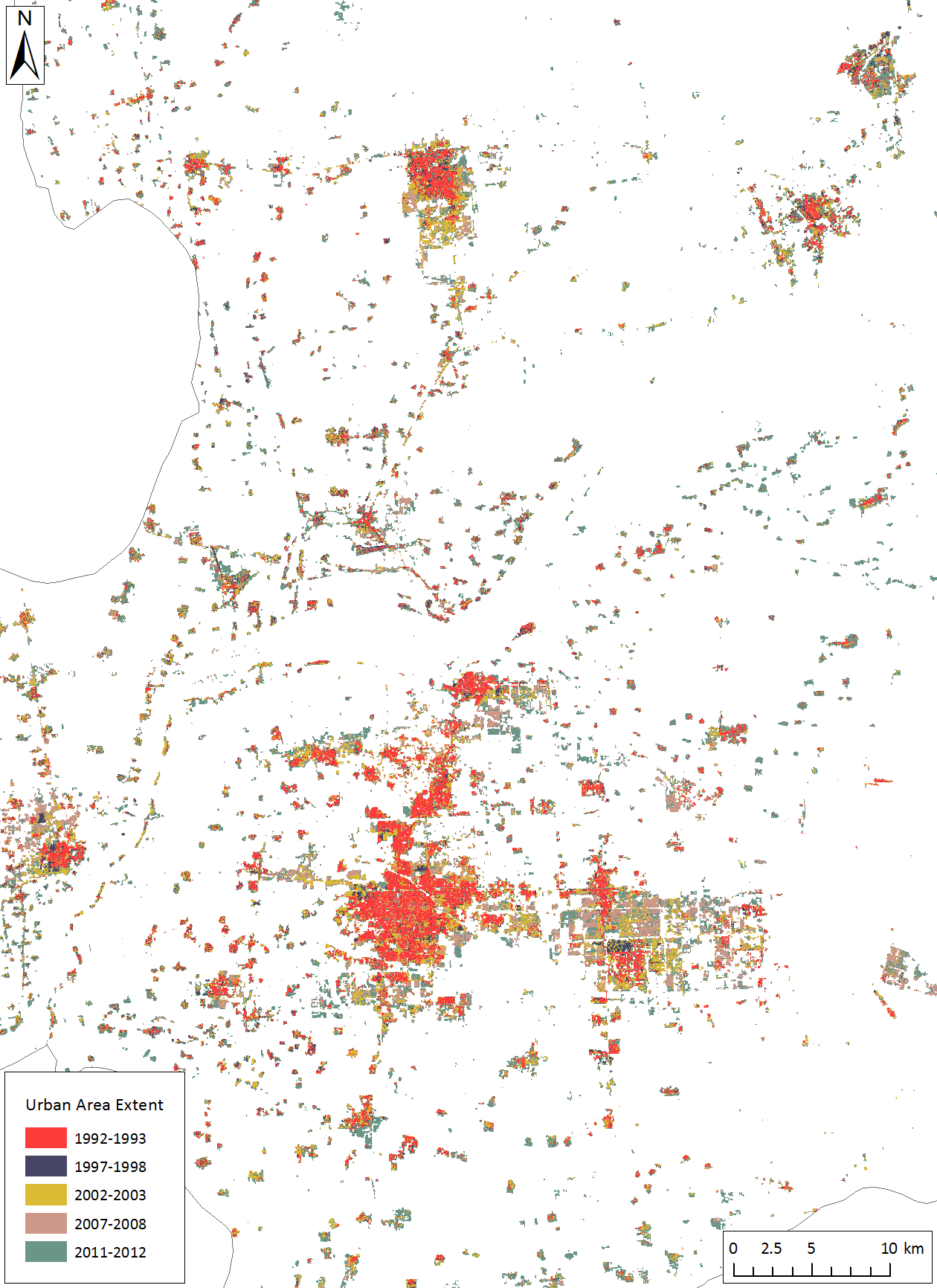
Fig.: Yellow River Delta - Urban area extent estimated using the implemented methodology by means of multitemporal Landsat-5 and Landsat-7 optical imagery in combination with multitemporal ERS PRI and ASAR IMP C-band SAR imagery for the periods 1992-1993, 1997-1998, 2002-2003, 2007-2008, in addition to the improved GUF derived from 2011-2012 TSX/TDX X-band SAR imagery. (publication under preparation)