Video News
User login
Who's online
There are currently 0 users online.
Sponsored by

![]()
Associated with

Development of an unsupervised methodology for detection of changed buildings based on very-high resolution EO data
A new methodology for detection of changed buildings in a highly structured test site in the Eastern part of Dongying was developed and evaluated which will be transferred to the whole city area. The experimental site comprises about 550 individual buildings which were visually classified into changed (i.e. newly constructed) and unchanged buildings in order to provide a reference map for accuracy assessment.
Multispectral QuickBird imagery from 2006 and WorldView data from 2013 are used as input data. (read on for automatic method)
In terms of data preprocessing, the two images were adjusted geometrically and radiometrically. Automatically derived building geometries were used for calculation of object-based difference features (multispectral features, ratios, texture) which were further processed by means of Principal Component Analysis (PCA). The clustering algorithm k-means was used for the change detection itself.
Concluding, this methodology for unsupervised change detection shows high potential for detecting the dynamic urban structure in Dongying and the Yellow River Delta with high accuracy.
(manuscript submitted to IEEE Journal of Selected Topics in Applied Earth Observations and Remote Sensing (J-STARS) for publication)
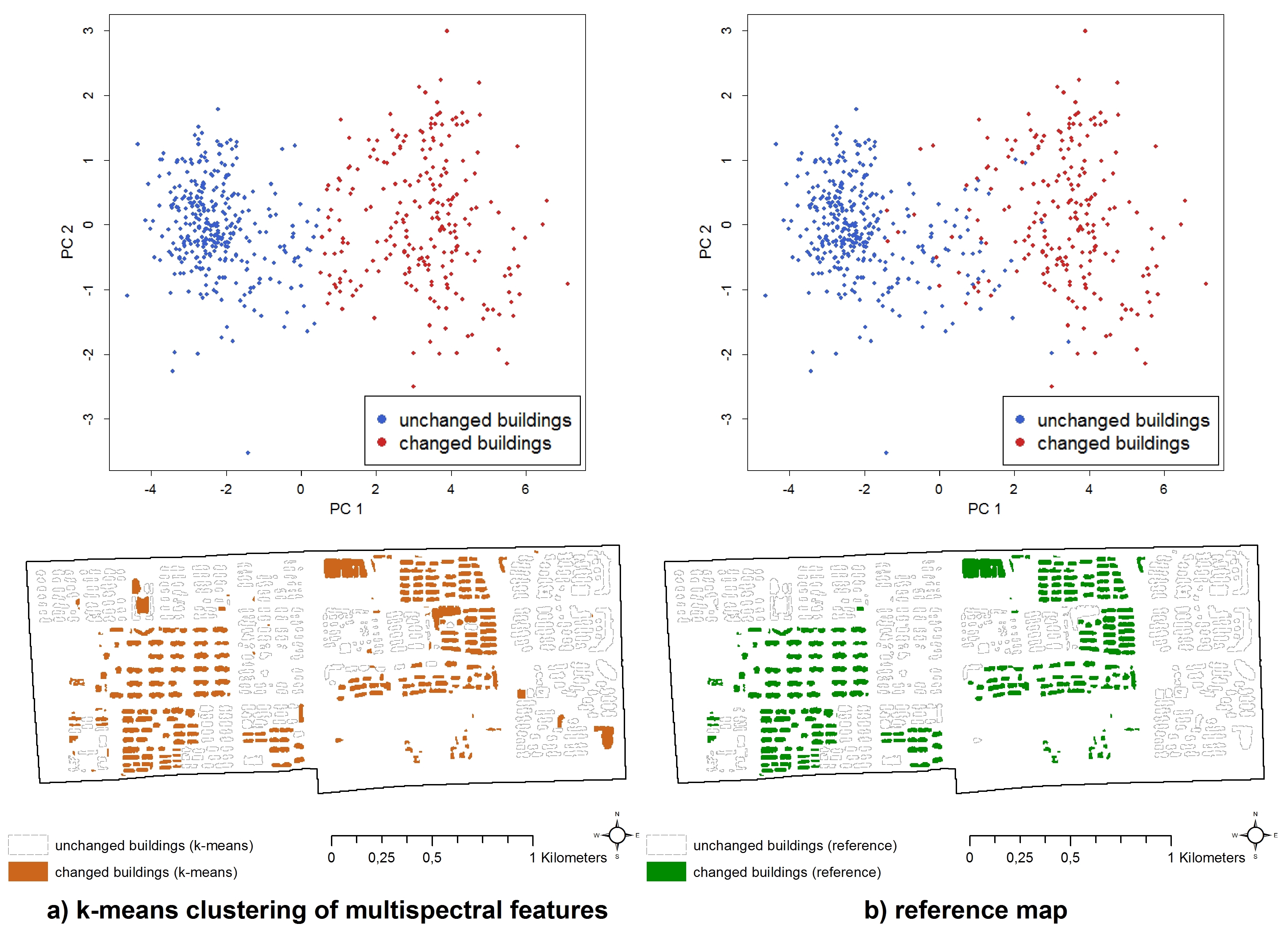
Fig.:Results of the unsupervised change detection approach in a test site in Eastern Dongying: a) results of k-means clustering of principal components of multispectral features (bottom) with corresponding scatterplot (top) b) reference map (bottom) with reference scatterplot of multispectral features (top)