Video News
User login
Who's online
There are currently 0 users online.
Sponsored by

![]()
Associated with

Agricultural Changes in the Yellow River Delta between 2004 and 2013
With the help of the Land Cover Maps from 2004 and 2013 generated and presented under Delta Dynamics already earlier post-classification change detection was performed with a focus on the development of the agricultural area in the Yellow River Delta. Therefore, the following figures show the conversion from agriculturally used fields into other land uses, as well as the amount of newly developed agricultural areas.
The quantification of the absolute values of change between 2004 and 2013 (9 years) reveals that 40km² of shrubs and 80km² of grassland were converted into agricultural land (Fig. 1). Regarding the conversion from agricultural area into other land uses these are comparably small areas. After the 9-year-observation period about 400km² were not used as agricultural land anymore, and shifted to other natural coverages such as grassland (Fig.2). More detailed analyses need to be conducted, but so far it could be assumed that this change could relate to the increasing salinization of soils in the Yellow River Delta. The observed change to/from bare soils (Fig.1,2) is mainly related to the later satellite data acquisition date and the probably more advanced harvest time in early October 2013. (publication in preparation)
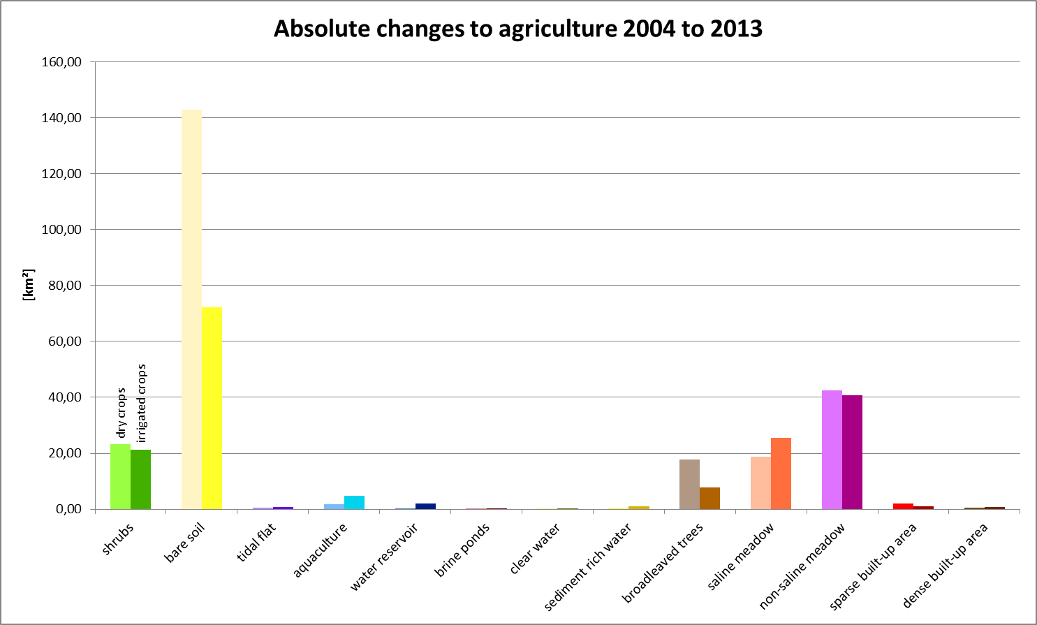
Fig.1: Conversion of land into agriculturally used land
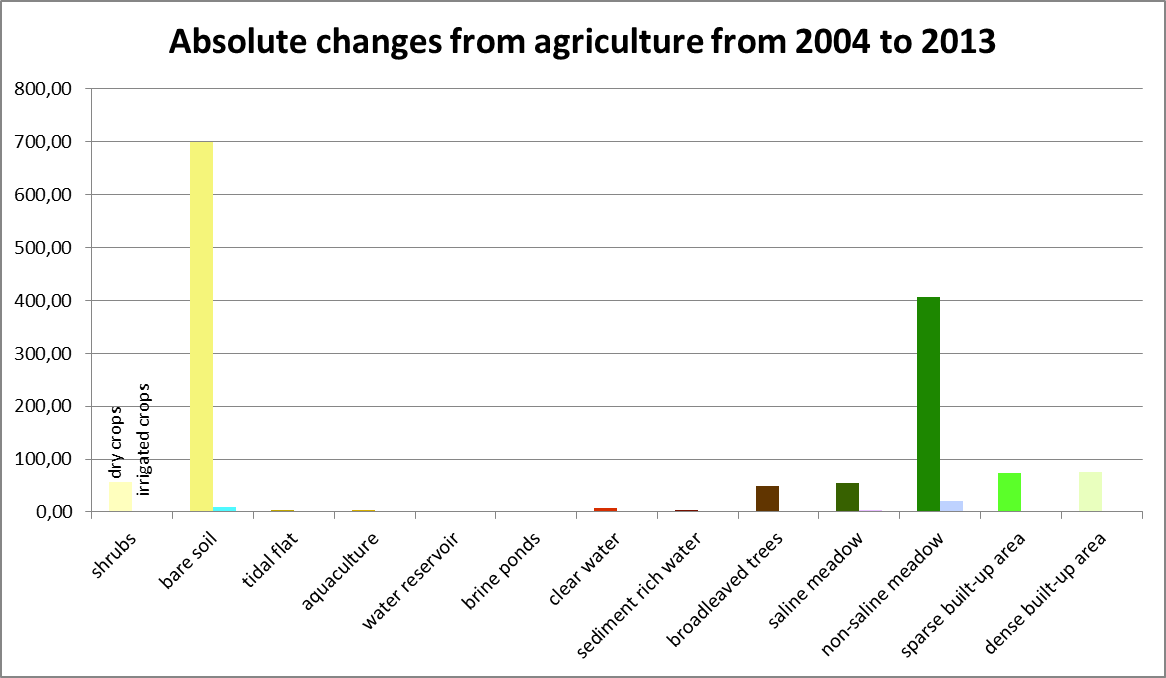
Fig.2: Changes from agricultural usage to other land uses