Video News
User login
Who's online
There are currently 0 users online.
Sponsored by

![]()
Associated with

Observation of aquaculture development
The aquaculture development in the Yellow River Delta can be observed from remote sensing data analyses. Classification of Landsat imagery from 1995 and 2010 reveals large area changes of land use at the northern and southern coast of the Yellow River Delta (Fig. 1). In 2010 aquaculture ponds cover a four times larger area compared to 1995 (Fig. 2). Furthermore, water reservoirs and brine ponds were constructed. Intensification of land use at the coast in this region could be an indicator for settlement development – aquaculture and brine ponds provide food (fish) and salt for a growing population.
Expansion of settlements in the Yellow River Delta started in the 1980s with oil exploration at Shengli oil field. This also corresponds to the results from 1995 were aquatic cultivation was not yet widely established in the Yellow River Delta. Further combined analyses on anthropogenic influences in the region can be found in Ottinger et al. 2013 (see under Publications-Journal Papers).
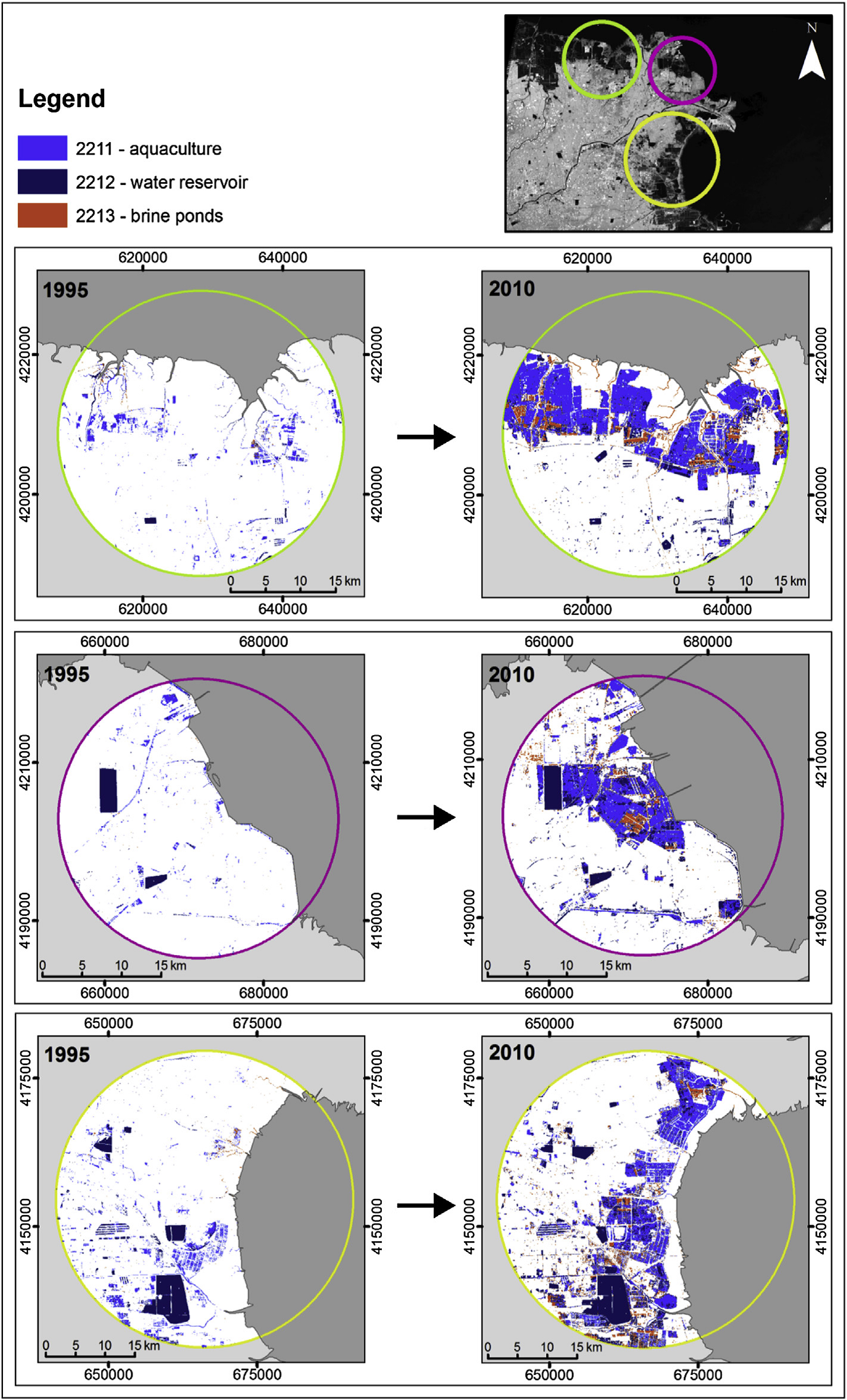
Fig.1: Map of changes of cultivated aquatic surface at the coast of the Yellow River Delta between 1995 and 2010 (source: Ottinger et al. 2013)
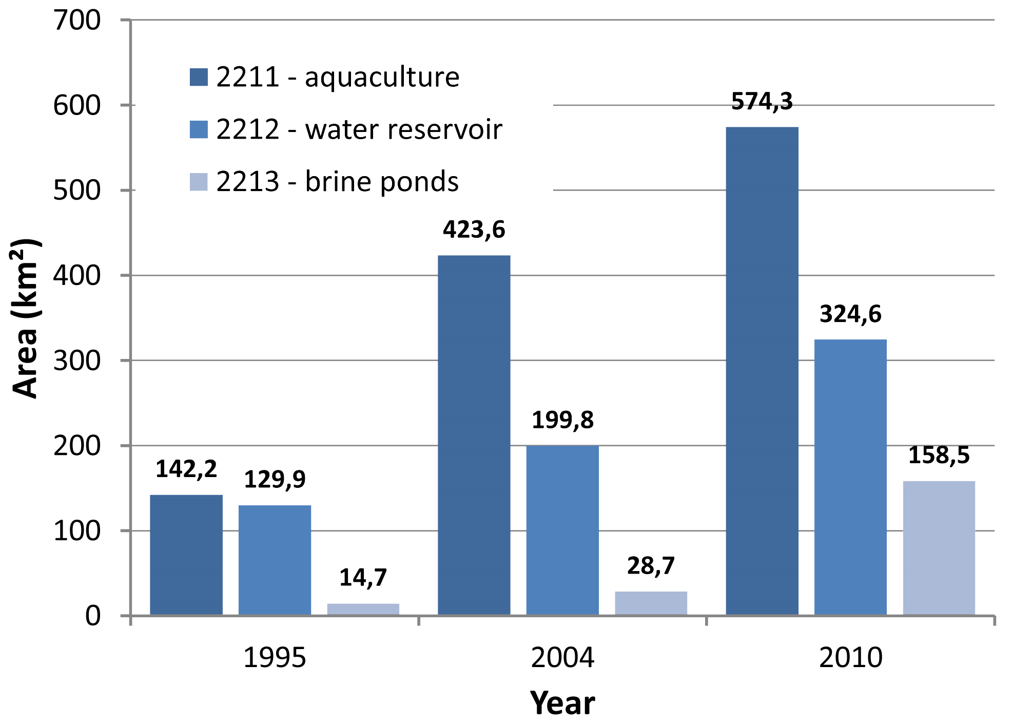
Fig.2: Quantitative information on changes of cultivated aquatic surface in Dongying municipality from 1995 to 2010 (source: Ottinger et al. 2013)