Video News
User login
Who's online
There are currently 0 users online.
Sponsored by

![]()
Associated with

Field measurements of hydrodynamics and circulation in the Yellow River Estuary
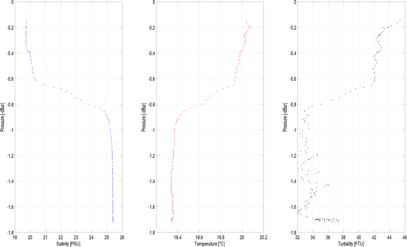
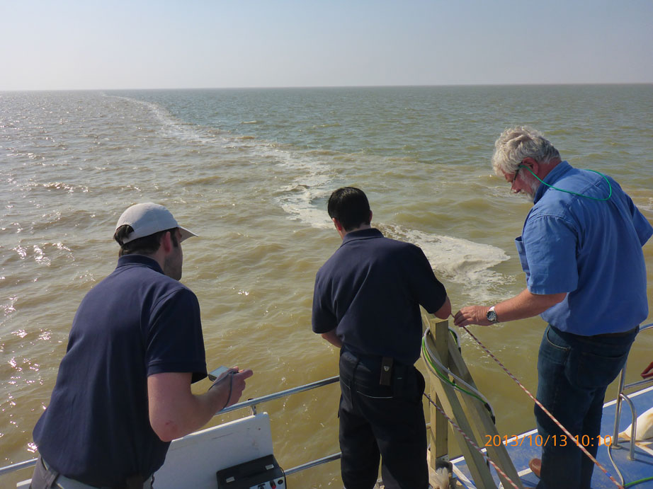
During the DELIGHT field campaign in October 2013, vessel-based measurements were taken in the 20 km long estuarine section of the lower Yellow River and in the near shore Bohai Sea. A sediment echo-sounder (SES) was used to record water depths and bottom stratification. Flow velocities and discharge were measured using an acoustic Doppler current profiler (ADCP). Furthermore, vertical profiles of temperature, salinity, turbidity and fluid density were recorded with a CTD probe that was lowered through the water column. Additional water samples were taken for further analysis.
The preliminary evaluation of the data shows that water depth mostly range between one and two meters in the river channel. Due to the bend in the estuarine section of the YRD, the deep channel is located close to the steep southeast bank while the northwest bank shows a more gradual slope. Salinities in the estuarine section range from around 0.4 PSU at the southeastern boundary of the survey area to around 25 PSU at the river mouth. Due to the shallow water depths and high sediment concentrations, a strong stratification of estuarine and marine waters can be found in the mixing zone leading to a vertical salinity gradient of more than 10 PSU in the turbidity zone. The data collected during the field campaign will be evaluated to gain a better understanding of the hydrodynamic and morphodynamic conditions as well as the estuarine circulation processes. It will further be used for setup and calibration of a 3D numerical Yellow River Estuary model.